Great Trinity Forest Trail Series
PART 1: Joppa Preserve to Trinity River Audubon Center
BY AMY MARTIN
Reprinted courtesy of GreenSourceDFW.org
The Trinity Forest and AT&T Trail (TFT) consists of over eight miles of paved trails linking Trinity River Audubon Center, Texas Horse Park, Trinity Forest Golf Club, and Joppa Preserve. Located in the Great Trinity Forest between Simpson Stuart Road and Elam Road just east of I-45, with Loop 12/Great Trinity Forest Way bisecting the area.
To some naturalists, the 12-foot-wide Trinity Forest Trail is an abomination. The concrete ribbon causes rain and floodwater to flow in ways that increase erosion, drown native plants, create mosquito breeding grounds, and more. It overrides the terrain, giving little tactile sense of nature, and facilitates access to delicate ecosystems by invasive plants and people with nefarious intent.
All true to some degree. But the TFT also brings the Great Trinity Forest to potential supporters who’d otherwise never see it, especially those with health and ambulatory issues. People won’t care about what they cannot see. Unlike soft-surface trails, TFT can get used in all but the rainiest of weather. It’s wheelchair friendly except for a few steep sections. It enables park rangers to keep an eye on parts of the Great Trinity Forest that evaded monitoring.
However you view the TFT, it’s here now. Increasing its use by nature lovers would go a long way to convincing city officials there is broad public support for the Great Trinity Forest. So let’s get to know the TFT. We’ll present the story in three installments.
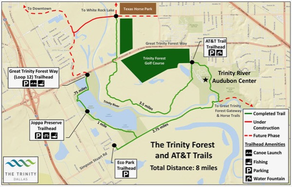
This Trinity Forest and AT&T Trail 2015 map still shows Lemmon Lake, which has since drained due to a dam breach. Courtesy of City of Dallas.See larger version of map.
TRINITY FOREST & AT&T TRAIL SERIES
May 13 2020
Part 1: Joppa Preserve to Trinity River Audubon Center
JOPPA PRESERVE TO TRINITY RIVER AUDUBON CENTER
Hiking companion: Texas master naturalist Michael Cook
Season: Mid-Winter
Distance: 7.5 miles
Time: The first leg from Joppa Preserve to the Trinity River Audubon Center and back took us about 4 hours to hike but we were moving fast. Allot six hours for a more leisurely pace.
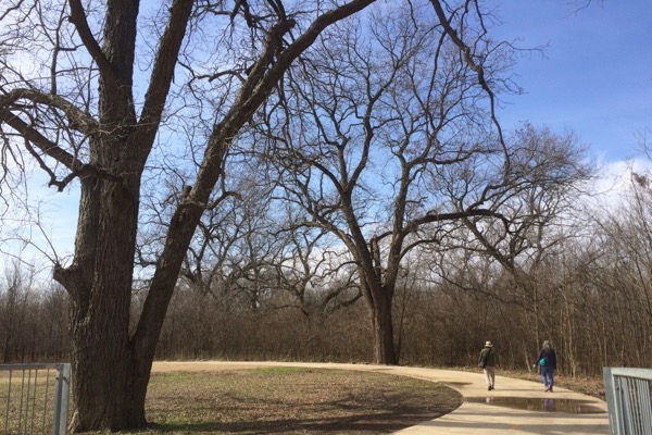
Big trees line the paved Trinity Forest Trail, photographed in January. Photo by Amy Martin.
THE HIKE
Visitors to the Joppa Preserve make their way to the long-in-the-tooth industrial district on the edge (and sometimes inside) the Trinity River floodplain. They rumble their way on a small tar road that is being devoured by potholes and climb a rise that contains multiple industrial railroad tracks.
On this perfect winter day in January, I cross the rise and am greeted by a man leading a horse on a rope. Michael had arrived early and discovered the horse wandering by itself. He grabbed the rope, walking the horse around until the relieved owner came.
Things are incongruous here in this quasi-rural industrial area on the southwestern edge of the Great Trinity Forest. Tucked amid industry and bottomlands, the Joppa Preserve park spreads out in green pastoral elegance with stone picnic shelters and barbeque grills.
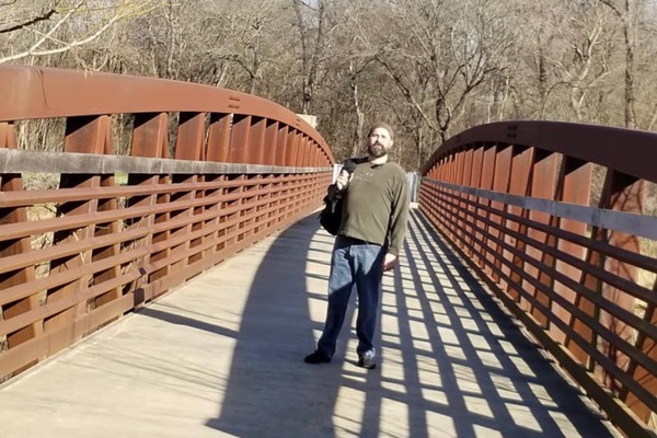
Michael Cook served as a guide to GSDFW reporter Amy Martin in midwinter. Photo by Amy Martin.
Michael and I set out south on the TFT. A perfect day for hiking - sunny and crisp with a light wind. We walk south along what maps and webpages claim to be Lemmon Lake. Yet there’s no lake there. (Read Chris Jackson’s story, Losing Lemmon Lake.) The former lake is now a mud plain dotted by large wet swales that support some shorebird activity, hidden from trail view by brushy overgrowth, mainly privet.
(Unfortunately, the city of Dallas map still shows Lemmon Lake, no doubt a disappointment to hikers looking for the landmark.)
We trudge past the quasi-lakeside privet-clogged woods, so thick on both sides of the trail that breezes barely penetrates and little sunlight filters through. We keep looking for a lake. It’s gloomy.
Once past the lost lake, the TFT encounters the trail segment that starts at the trailhead at EcoPark, headquarters of the city’s waste reduction and recycling educational outreach. The boring broad trail traces the abandoned west end of Simpson Stuart Road. McCommas Bluff Landfill lies to the south, the direction of prevailing odiferous winds. To avoid Lemmon Lake’s privet tunnels, start at the EcoPark trailhead.
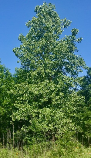
Cottonwood in spring. Photo by Amy Martin.
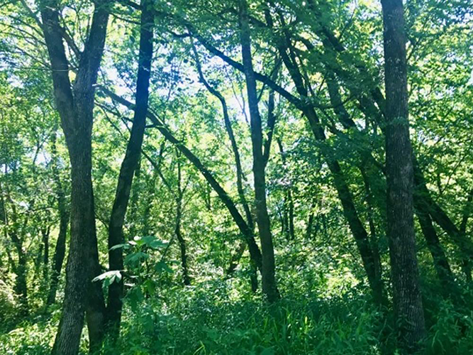
Once the trail nears the Trinity, the bottomland forest spread out in its spare winter glory. Trees topping three stories and 150 years of age, not just occasionally, but lots of them! We score handfuls of flavorful native pecans! And observe plentiful rooting damage from wild hogs who also like pecans.
Gray metal fancy fencing along a ramp leads to a brown metal-beam bridge over the river. It’s flanked by weird shade structures that cast little shade with rock benches. Best view of the Trinity ever, you can get right over it. The river isn’t trashy here. It’s lovely.
TFT continues through bottomland forest and slightly thick understory, but at least it isn’t all privet. And so much poison ivy in the forest! We admire mighty trees, linger along the river, and soak in quiet and clean air.
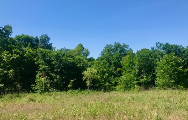
Meadow and trees. Photo by Amy Martin.
As the trail curves toward Trinity River Audubon Center, a wide dirt trail going off the other direction is too fascinating to resist. It aims straight toward McCommas Bluff Preserve through plentiful ash trees and a healthy understory. Elam Creek is too high to cross at the old lock, so we stay a while as Michael, a bug fiend, identifies colorful inhabitants of the trees.
Plentiful birdsong. Truly, it is constant. Significant flocks of cardinals and robins, scattered phoebes and swifts, and ever-present sparrows in a variety of species.
TFT skirts the backside of TRAC with its ponds and prairie. Very interesting to see them from a different perspective. Across from it is the remediation area from when it was an illegal dump, profiled in a 20-minute documentary Out of Deepwood. Though the light is getting dim, Michael can still see hawks and kestrels hunting above the open area.
Our goal is the parking lot outside of the TRAC gates. From there, the TFT meanders about three miles through the Great Trinity Forest and the east side of the Trinity to Loop 12/Great Trinity Forest Way. We hustle back down the trail to Joppa. As we turn on to the Simpson Stuart Road stretch of TFT, which aims west, a splendid sunset rewards our hiking efforts.
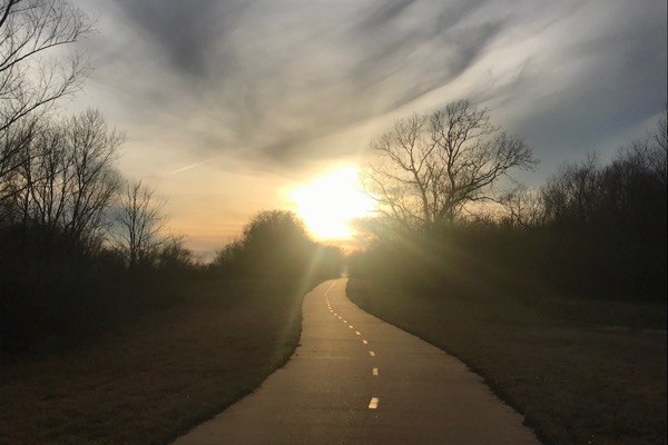
Sunset over Simpson Stuart Road marks the end of our journey. The road runs along the southern edge of Joppa Preserve and deadends at Eco Park trailhead. Photo by Amy Martin.
Trinity Forest and AT&T Trail
About: Trail featuring more than eight miles of paved trails linking Trinity River Audubon Center, Texas Horse Park, Trinity Forest Golf Club, and Joppa Preserve. Located in the Great Trinity Forest between Simpson Stuart Road and Elam Road just east of I-45, with Loop 12/Great Trinity Forest Way bisecting the area. See map.
Access:
AT&T Trail Trailhead: Located on the road to Trinity River Audubon Center. Illuminated clean parking lot, lightly patrolled on nights and weekends.
EcoPark Trailhead: Clean parking lot, but in area of little oversight on nights and weekends.
Joppa Preserve Trailhead: Access is off TX 310, also known as S. Central Expy., which parallels US 175 for a while. Turn on River Oaks; look for WW Roland Trucking. Go 3/10 of a mile. Only trailhead with bathrooms.
Trinity Forest Way (Loop 12) Trailhead: Odd parking lot below Loop 12 in area of little oversight. Very close to the river; parking lot floods occasionally. Look for the wildlife-warning sign with images of tigers and cobras.
Great Trinity Forest Features:
Blog contents Courtesy of GreenSourceDFW.org
Go to Great Trinity Forest Trail Series BY AMY MARTIN to read the original article.
